Pacific Northwest Road Trips
The Pacific Northwest is known for its open spaces, and its vast beauty is easily explored by car.
Gary Weathers/Getty Images
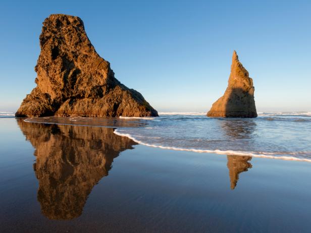
The Pacific Northwest is known for its open spaces, and its vast beauty is easily explored by car. With this in mind, we've pulled together 4 popular road trips through various portions of Washington and Oregon. The drives represent the diversity of the region -- from sea to mountains and even high desert. Hit the road in summer to put yourself in position for the best weather.
Beyond "Twilight"
State: Washington
Distance: Approximately 350 miles
Main roads: Highway 101, State Routes 305, 3, 104, 19, 20
Time: 2-3 days
Highlights: The success of the "Twilight" books and movies has shined a spotlight on Forks, WA, but the entire Olympic Peninsula is worth a closer look.

Feng Wei Photography/Getty Images
From the ferry terminal on Bainbridge Island (there's daily ferry service from Seattle), head north on State Routes 305 and 3 toward Poulsbo. Hang a left on SR 104 over the Hood Canal Bridge and follow SRs 19 and 20 to the quaint Victorian town of Port Townsend. Here, after strolling around the historic buildings of Water Street, drive up the hill for a lunch of Alaskan Salmon B.L.T. at Sweet Laurette's Cafe and Bistro, and overnight in one of the old officer's quarters at Fort Worden State Park.
Double back on SR 20 to Highway 101, and motor through the towns of Sequim and Port Angeles into Olympic National Park. At Lake Crescent, pull over and hike the 1.5-mile trail to Marymere Falls; later, take the 15-mile turn-off toward Sol Duc Hot Springs, and soak in the 108-degree pool. As you drive around, be sure to stop in Forks, scene of the fictional "Twilight" series, and shop for Edward Cullen tchochkes.
South of Forks, side-trip 25 miles out the old Hoh River Road for a hike along the Hoh Rainforest Trail, the most popular trail in the entire park. Back on Highway 101, spend a second night at Kalaloch Lodge on the bluffs overlooking the mighty Pacific. Be sure to hit the Enchanted Valley near Lake Quinault for some elk- and eagle-watching before heading toward Olympia and Seattle.
Fruit of Panorama Land
State: Washington
Distance: Approximately 200 miles
Main roads: I-395, Highway 2, State Routes 20 and 25
Time: 10 hours
Highlights: Farm stands in the northeast corner of Washington overflow every summer with peaches, apples and cherries, making "Panorama Land" a good road trip for the hungry.
Lisa Kyle Young/Getty Images
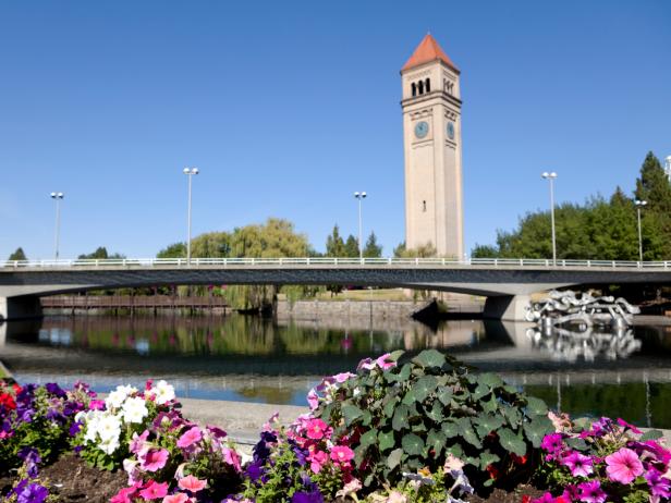
Start the drive in downtown Spokane, and head north along I-395 past rolling hills made verdant from the waters of the Columbia River. Fruit trees begin to dot the landscape after Colville, and in Kettle Falls, the community seems to come to life. This is the de facto capital of the region, and Meyers Falls Market, the local grocery store/taqueria/wine bar, is the de facto local community center. It also happens to be a great place to grab a sack lunch.
From the market, turn right (north) on State Route 25. Riverview Orchard, the first major farm stand, specializes in (you-pick) nectarines and pears, but also sells local honey. Owners John and Janet Crandall roast their own coffee as well. Next, check out Cliffside Orchard, which sits on a cliff overlooking the river and Lake Roosevelt. This spot is all about fresh cherries -- 3-lb. bags sell for less than $10. The fruit is as sweet as candy.
For some of the region's best produce, head back toward town, then west on I-395; cross the rickety metal bridge, and follow signs for State Route 20. After a few miles, the signs for Peachcrest Fruitbasket Organic Farm will appear. As the name suggests, this spot is all about peaches: juicy white and yellow peaches the size of softballs. Buy them by the pound, and be sure to buy some extras for the ride along SR 20 and Highway 2 back to Spokane.
Going Gorge-ous
State: Oregon/Washington
Distance: 200 miles round-trip
Main roads: Interstate 84, OR State Routes 30 and 197, WA State Route 14
Time: 10 hours
Highlights: A round-trip excursion through the Columbia River Gorge National Scenic Area is one of the most beautiful drives in the Pacific Northwest.
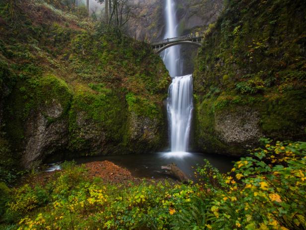
Atan Chua/Moment/Getty Images
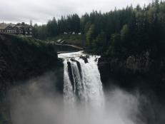
Start the adventure on the Oregon side of the river in Portland, and head east on I-84 (which is also State Route 30). The road escapes the suburbs and comes upon Multnomah Falls east of Troutdale. Here, Multnomah Creek drops more than 600 feet, cascading into 2 separate pools on its way down. The view from the top of a trail that scales a nearby bluff is impressive, but the best perspective comes from the stone Benson Footbridge that crosses the creek near the lower falls.
Past Hood River, in the town of Mosier, it's time to hike, as visitors can tromp through twin tunnels that once were part of the drive on old Highway 30. The tunnels, dubbed the "Mosier Tunnels," were built in the early part of the 1900s and now comprise a 10-mile round-trip hike. Bring a flashlight and look for graffiti, some of which is reputed to date back to 1921, when a snowstorm trapped motorists inside.
Continue east into The Dalles, and grab a plate of home-cooked meatloaf at Cousins Restaurant & Saloon; then cross the river over Highway 197 and motor into Washington. Along Highway 14 -- the "Lewis and Clark Highway" -- development is sparse. The lone highlight: tours (guided and self-guided) of the Bonneville Dam, which supplies hydroelectric power to just about all of the hotel rooms in downtown Portland and beyond.
Through Hells and Back
State: Oregon
Distance: Approximately 250 miles
Main roads: Interstate 84, State Routes 82 and 86, Forest Roads 39 and 3365
Time: 2-3 days
Highlights: Located at the northeast corner of Oregon, the Hells Canyon Scenic Byway brings road-trippers face-to-face with the Snake and Wallowa rivers and surrounding lands.
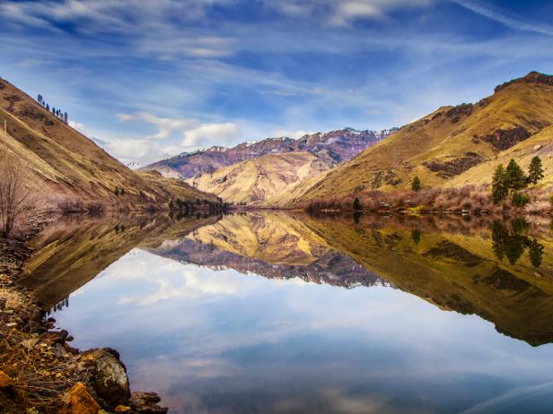
Octaviano Merecias Fotografia Photography/Moment Open/Getty Images
The drive begins at the intersection of I-84 and State Route 82. Take a few hours to look for eagles at the Ladd Marsh Wildlife Area, and stop to walk around historic downtown La Grande. In Elgin, catch a movie at the beautifully restored Elgin Opera House, built in 1912. Near Joseph, take a short detour to explore Wallowa Lake. Don't miss the Wallowa Lake Tramway to the top of 8,300-foot Mt. Howard, from which there are great views.
Turn south on FR 39, from which point the attractions are all natural, part of the Hells Canyon National Recreation Area. First: the Snake River, which you can hear before you actually see. Next: the Hells Canyon Overlook, a brief side trip. The river is designated as wild and scenic below the Hells Canyon Dam, which means you can pull over and hike down to river's edge. From there, the towering canyon walls look imposing, to say the least. The experience gives new meaning to the notion of "tunnel vision."
The final leg of this scenic trip begins when the route jogs west along State Route 86 outside of Halfway (which changed its name to Half.com during the dot-com boom). Bring some fishing poles, and cast for bass inside Hewitt/Holcomb Park near Richmond. The route crosses the historic Oregon Trail about 5 miles east of Baker City, where travelers can bone up on history at the National Oregon Trail Interpretive Center, before returning to the Interstate.
MORE: The Pacific Coast Highway: Top 10 Locals List














.jpg.rend.hgtvcom.231.174.suffix/1674758726773.jpeg)


