Roaming With: Trailblazer Travis Hall
Wouldn’t you like to take time off from work to travel or enjoy your favorite recreational activity whenever you wanted? For most people that’s a fantasy but for Travis Hall it’s a lifestyle choice. An experienced hiker and camper based in Townsend, Tennessee, Hall has been hiking long distances since 2000 and is a genuine “900 miler,” someone who has hiked all the trails in the Great Smoky Mountains National Park. He usually hikes an average of three days a week and has that flexibility because he is the sole owner and operator of Travis Hair Design noting, “Everyone thinks it’s unusual for a mountain hiking guy to be a hair stylist, but it lends itself very well to being able to do these things.”

Travis Hall
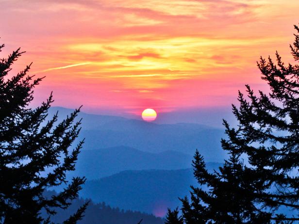
Hall is currently focused on increasing awareness of the Smoke Ring Trail, his self-coined name for the 260 mile loop in the Great Smoky Mountains National Park that allows hikers to experience the rich diversity of flora, fauna and seasonal changes in the park. It also gives them access to the most beautiful and remote trails. Hall is quick to admit that, “The Smoke Ring Trail is not an official trail name, but I do dream that the route might someday become official and that its popularity might help the park protect and improve its backcountry trails and its borders from the encroachment of private landowners and development.“ Hall has already created the logo for his Smoke Ring Trail and is in the process of designing a detailed map of it.
Travis Hall
What makes the Smoke Ring Trail unique is that a hiker can visit numerous “forest environments in rapid succession throughout a hike that one would otherwise have to travel a thousand miles cross-country to see. With the exception of the rocky, alpine, above-tree-line environments of Maine and New Hampshire, you can pretty much experience all the other wonders of the 2200 mile Appalachian Trail in this one 260 mile loop hike.” Hall also adds that the Smoke Ring Trail is ideal for hikers and campers because it is surrounded by cross roads and six accessible towns where they can go for supplies, catch a shuttle to another area or enjoy a local restaurant or resort. For information on fees, permits, fishing and other activities, visit the official website of the Great Smoky Mountains National Park for their downloadable trip planner.
Travis Hall
What motivated you to create this unique approach to experiencing the Great Smoky Mountains National Park?
A long distance hike is an experience of spiritual awakening for me. It’s an opportunity to become more and more present in the moment through the constant meditation of the art of walking and to experience the truest nature, wonder and beauty of our existence. It is in fact the very essence of what distance-hikers refer to as "trail magic." A hike of some length, away from the world, has the ability to introduce people to this source of wonder. This is the true core of my longing to establish the Smoke Ring Trail.

Travis Hall
Is everything clearly marked in the park in terms of trail signs and directions?
All the trails are pre-existing and, because they are all in the national park, they are well marked and easy to follow. A lot of junctions offer more than one direction so you would need a map to make sure you are taking the right trail. Quite frankly, the one dollar park map that is available at any ranger station is the main thing you need.
The trails, road walks and distances involved in the Smoke Ring Trail begin at the “Y” in Townsend and travel counterclockwise. But a hiker could begin on any border trail at any point around the park, then take all the right hand turns if they are traveling counterclockwise (staying to the outer border) or left turns if they are traveling clockwise with road walks of .5 miles between the Lakeview tunnel and Noland Creek trail, 3 miles on 441 between Mingus Mill and Smokemont, 5 miles on Balsam Mt. Rd between Balsam Mt. trail and Flat Creek Trail, 1.8 miles through Little Cataloochee Valley to link the Boogerman Trail and Little Cataloochee Trail (and hopefully see the elk herd), .7 miles between Baxter Creek Trail and Chestnut Branch Trail, and an optional 1.5 miles between Twin Creeks Trail and the Gatlinburg Trail. At one end of the loop there is a very famous resort called The Swag. It’s real high-dollar and at the other end is Blackberry Farm, which is one of the top resorts in the world. If someone had a tremendous budget to hike the Smoke Ring Trail, they could plan to stay at either of these fine resorts along the way.
Travis Hall
What do you recommend for a novice day hiker who has never visited the Great Smoky Mountains National Park and wants to experience a portion of your Smoke Ring Trail?
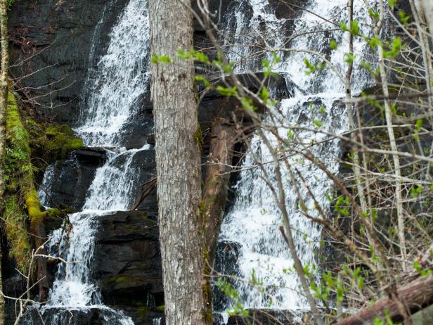
It’s all really beautiful hiking, but it would be more a matter of what to possibly avoid for a day hike. The trail goes right into Gatlinburg, for instance, and that’s going to be crowded so, I would avoid the trail as it enters or leaves Gatlinburg. But the Big Creek area is wonderful and so is the Little Cataloochee area. Deep Creek is known for having the highest concentration of waterfalls, and the Smoke Ring Trail goes right through Deep Creek. It’s a border trail, and it does cross rivers at their widest point, but it also gains very high elevation through the park and back down so, you see a little bit of everything. The Boogerman Trail in Cataloochee Valley is another highlight and one of our largest sections of old growth forests with really large trees.

Travis Hall
Can you share some of the seasonal highlights a hiker might experience?
Fall is amazing in the Smokies. There is so much color. At the start of fall through the entire leaf change is roughly a three-week period. Spring is all about the wildflowers and the leaf bloom. The leaf foliage was just beginning as I started my hike and by the time I finished I was completely in the shade. The wildflowers are so prolific. There were times you could walk around a bend in a cove or a mountain and everything would be white flowers, and just as you got on the other side of the bend, suddenly the forest floor would be covered with an entirely different color flower. It is constantly changing.
Travis Hall
What kinds of wildlife might a hiker encounter on the trails?
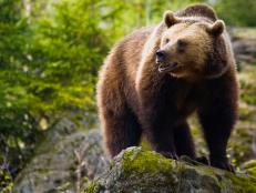
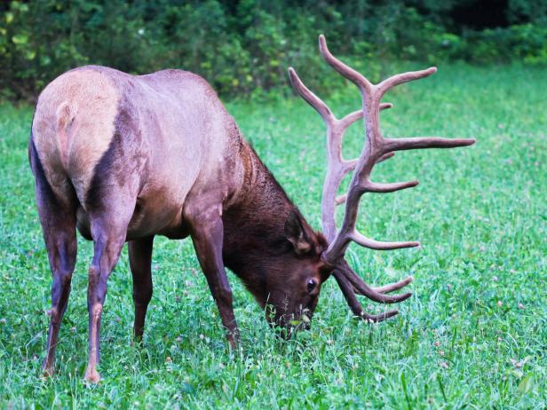
Bears are very common in the national park. It’s one of the highest concentrations in the Appalachian range, and I see them frequently. In my 25 years of hiking in the park I have never had a bad bear experience, and I’ve seen at least 80 bears. You might also see wild boar and elk. You might see otters when you’re in the wider parts of the rivers. The otter population has actually increased in recent years. Raccoons and squirrels, of course, are everywhere. The most dangerous animal in the park is the grouse because it’s more likely to give you a heart attack. When I’m humping it up a hill and I spook a grouse about 5 feet away I always feel like that’s the most dangerous thing that’s going to happen to me (laughs).
What are some crucial items you always carry with you when you hike?
Water treatment of some sort. I use a chemical system called Aquarmira which is a two-part water purification system, and I would never want to leave home without a way to treat my drinking water. And I never hike without my shepherd’s crook [a walking stick that was a gift from a friend]. If I drove a hundred miles to go on a hike and I forgot my shepherd’s crook, I probably just wouldn’t do the hike. (laughs) It’s been there for me through thick and thin and is why they call me Shepherd [his trail name].
Travis Hall
